The first image has a Sea Level setting at 1, and second is set to 5 (out of 9):
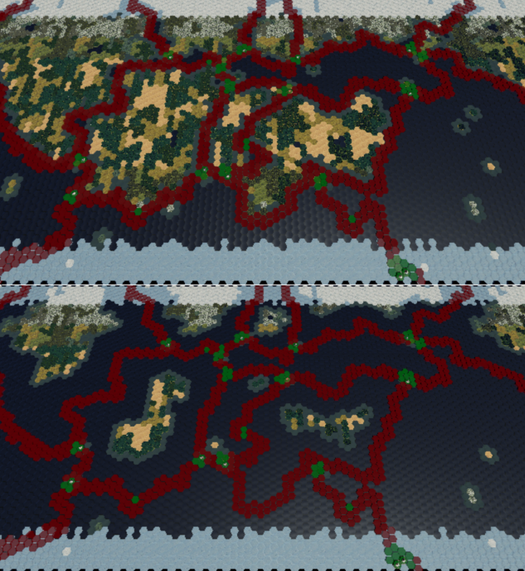
In the second image the sea level is a little higher than I expected for 50%, but that was easily corrected by increasing the number of land seeds found in the continents. If you look at the west-most equatorial continent, increasing the seed count increased it’s width from 3 to ~5 tiles which is pretty much on par for 50%.
So those images are without any convergent plate boundaries bulking up continent mass. If a player chooses a very high tectonic activity with a very high sea level, they aren’t going to have much water(other than plates designated as oceans) despite the high sea level. Another way to break up continents would be to use a low uniformity setting which would allow many more water seeds in each continental plate to break them up. Either way, the UI for the map creation screen will have it’s work cut out for it to relay this kind of information to the player. Lots of preset templates to be had for sure.